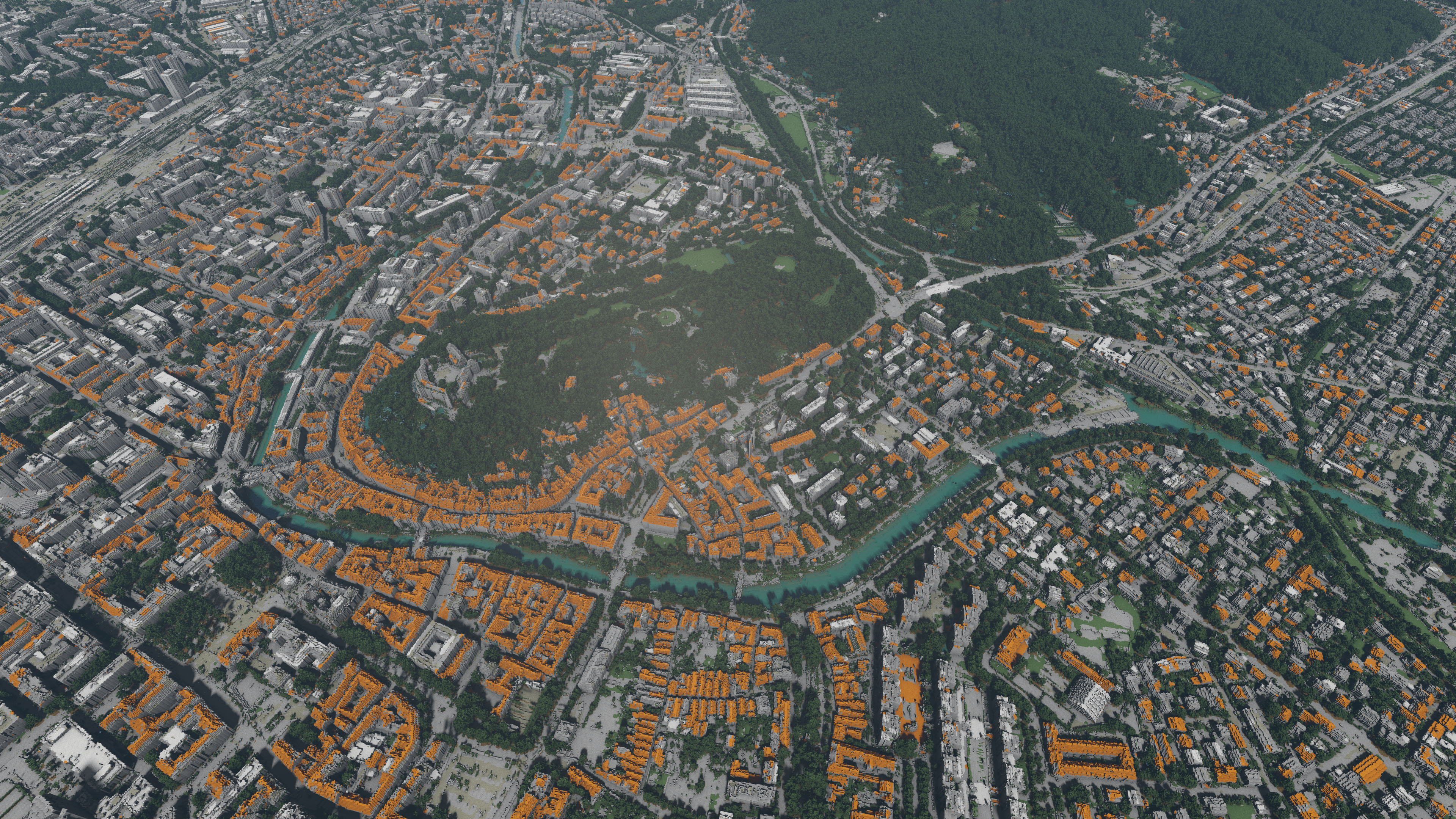
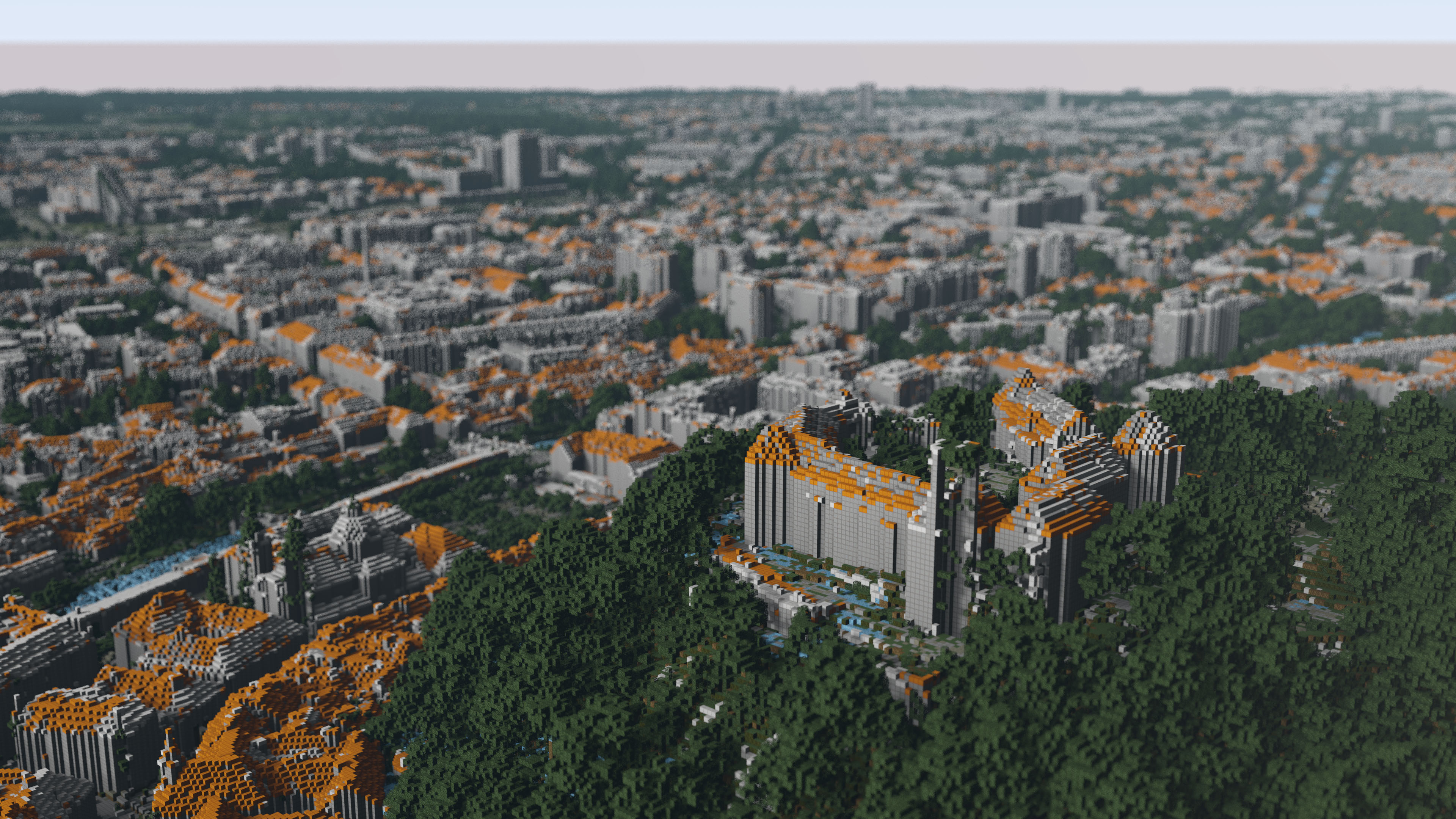
Ljubljana from a distance, where the resulting image seems photorealistic.
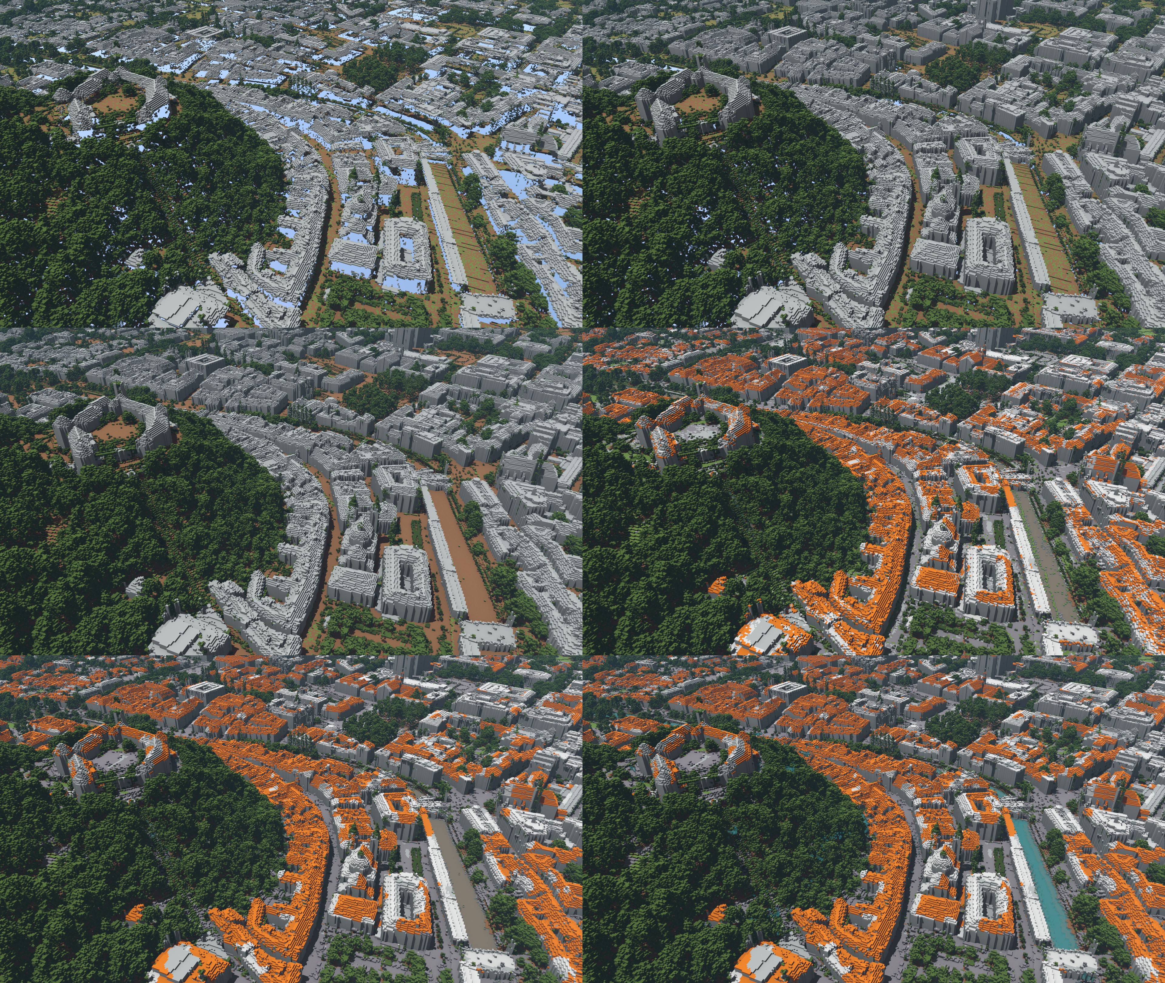
Ljubljana from distance in different steps of specialization process. Top left - quantization, top right - building fill, middle let - ground fill, middle right - colour specialization, bottom left - filtering and bottom right - water deepening and equalization
The goal of the project is to develop a web-based visualisation framework that visualises LIDAR terrain data as voxel-based (Minecraft-like) worlds with a realistic ray-tracing based renderer.
The LIDAR (LIght Detection And Ranging) data is openly accessible from Slovenian Environment Agency since late 2015. It is categorised into 5 classes: 3 heights of vegetation, ground and buildings. We fused the LIDAR data with DOF (Digital Orto-Foto) data for better final composition and coloring. We supplemented the missing building data and added water information from DOF data.
For the purpose of visualization, we developed an interface that enables users to choose a geographical region, select appropriate parameters and produce final rendering of selected area.
References:
-
![[PDF]](http://lgm.fri.uni-lj.si/wp-content/plugins/papercite/img/pdf.png) M. Lunar, C. Bohak, and M. Marolt, "Distributed ray tracing for rendering voxelized lidar geospatial data," in Zbornik petindvajsete mednarodne elektrotehniške in računalniške konference erk 2016, 19. - 21. september 2016, portorož, slovenija, 2016, pp. 55-58.
M. Lunar, C. Bohak, and M. Marolt, "Distributed ray tracing for rendering voxelized lidar geospatial data," in Zbornik petindvajsete mednarodne elektrotehniške in računalniške konference erk 2016, 19. - 21. september 2016, portorož, slovenija, 2016, pp. 55-58.
[Bibtex]@conference{1537129667, author={Miha Lunar and Ciril Bohak and Matija Marolt}, year={2016}, pages={55-58}, title={Distributed ray tracing for rendering voxelized LIDAR geospatial data}, booktitle={Zbornik petindvajsete mednarodne Elektrotehniške in računalniške konference ERK 2016, 19. - 21. september 2016, Portorož, Slovenija}, }
Data is provided by The Surveying and Mapping Authority of the Republic of Slovenia and Slovenian Environment Agency: